Bamberg sits where the Regnitz splits into two arms around the island city, and that fork explains the layout: the Old Town Hall marooned between the channels, the fishermen's cottages of Klein Venedig along the eastern bank, and the Main-Danube Canal cutting in from the north. Bamberg Tourismus organises its visitor information around three parts of the city, the Inselstadt, Bergstadt and Gärtnerstadt, and walking the riverbank is the simplest way to see how they fit together. A self-guided route covering the city's main sights is described by one walking guide as taking about a day, a useful benchmark for the suggested half-day riverside loop below.
The route below is a suggested loop, not official guidance, and any timing is a rough budget rather than a promise. It starts at the Altes Rathaus, runs north along the Regnitz and canal-side paths toward the Hain, then returns through the Gärtnerstadt so you never reverse along the same bank. Where a source gives an exact figure, it is cited to that source; where it is a planning estimate, it is labelled as one.
Why the Regnitz Corridor Reads Bamberg Best
Bamberg is presented by its tourism authority as a city of three distinct parts, and the river is the thread connecting them. From the water's edge you look up at the hill city with the cathedral and Michaelsberg, across at the island city with its pedestrian core, and north toward the garden district where market gardening was historically a way of life. That single vantage point saves you from treating the city as a checklist of separate sights. For wider planning, see Bamberg landmark visitor guides.
The Regnitz is the river you follow through town, while the Main-Danube Canal joins the picture on the northern edge as a modern navigation route. Bamberg Tourismus describes boat excursions starting in the old town and heading along Little Venice toward the harbour and the confluence of the Regnitz and the Main with the Main-Danube Canal. Knowing that the two waterways run near each other but are not the same thing prevents the common mistake of expecting canal traffic in the middle of the old town.
If your priority is comparing routes rather than following one, the broader Bamberg landmark pages break the city down by individual sight so you can decide what deserves your time on foot. The riverside corridor rewards you most when you let it string those sights together in a single direction of travel.
Route Logic: One Direction, No Backtracking
The efficient loop is simple in concept: begin at the island city, head downstream and north along the Regnitz, continue past the canal-side paths, then return through the Market Gardeners' District. Because the Regnitz and the canal occupy different lines on the map, this returns you on a different street grid rather than sending you back the way you came. The payoff is a walk where almost every step is new ground.
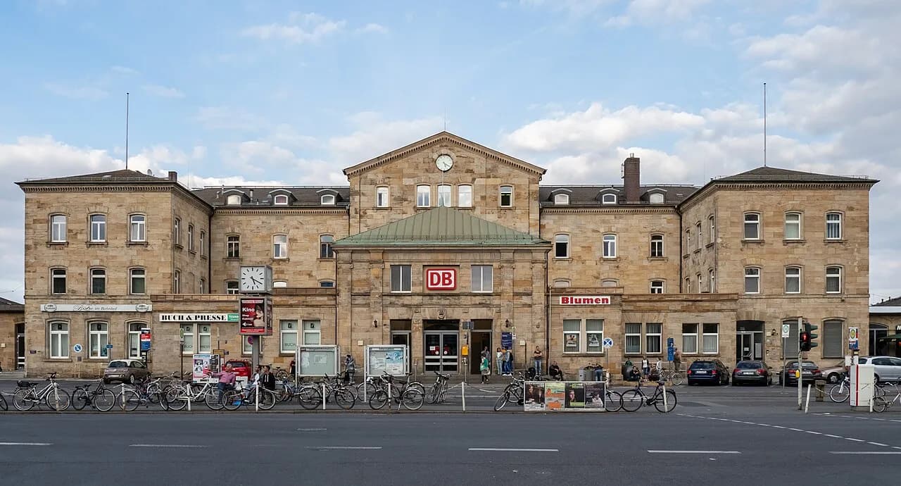
A self-guided route published by one walking guide starts from Bamberg Train Station, crosses a bridge over the Main-Danube Canal, and finishes through the Market Gardeners' District with its museum and remaining market gardens. That description is useful as a structural cue rather than a fixed itinerary, since the exact streets depend on how much you detour. The same guide describes the old town as about a kilometre from the station, a reasonable planning figure for the final leg.
The garden district is worth a slower look, since it is one of the three parts of the city that Bamberg's tourism authority highlights alongside the island and hill districts. It is also where the loop naturally deposits you back toward the station and the northern edge of the old town.
Starting at the Old Town Hall and Geyerswörthsteg
Begin on the Obere Brücke, the upper bridge that carries you onto the island where the Old Town Hall sits between the two arms of the Regnitz. The building's two bridges and its position over the water are the classic Bamberg view, and walking through it puts you on the far bank ready to turn north. Treat the Altes Rathaus as a landmark on your route rather than a stop you must pay to enter.
Cross the Geyerswörthsteg footbridge for the best angle back at the Old Town Hall, then continue to the quieter bank. This is the natural hinge of the walk: from here you commit to the downstream route and stop circling the island. If you want more background on what the Old Town Hall actually houses, including the Sammlung Ludwig porcelain collection, keep that for a separate, focused visit rather than interrupting the riverside flow.
Klein Venedig: The Fishermen's Quarter on the Water
Klein Venedig, or Little Venice, is a row of small half-timbered houses on the riverbank, historically fishermen's cottages rather than anything Venetian in style. One walking guide notes that the buildings date largely from the seventeenth century, that some lean noticeably over the water, and that at least one gondola is moored on the river. Naming the place after Venice is a bit of a misnomer, and knowing that helps you look at the cottages for what they are.
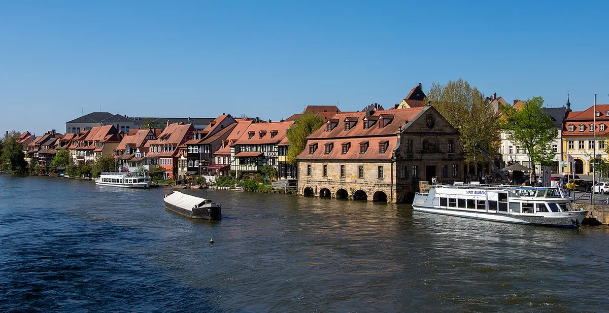
These are homes and former working buildings, not a museum set, so view them from the path and the bridges instead of approaching doorways. The excursion boats pass this stretch on their way between the old town and the harbour, which is one reason the shoreline stays visually busy. If Little Venice is your main reason for the walk, a dedicated page on the quarter lets you dig into its history separately.
Boat Excursion or Towpath: Choosing Between River and Path
The organised boat trip is the river-level alternative to walking the same water. Bamberg's tourism authority lists the operator as Schiffsrundfahrten Personen-Schifffahrt Kropf, describes an eighty-minute circuit from the old town past Little Venice toward the harbour and the Regnitz-Main confluence, and gives a seasonal pattern of operation from March to the end of October with departures from eleven in the morning and extra tours possible. Treat that pattern as the organiser's published seasonal framework and confirm current times and fares directly with the operator before relying on them, since such details change.
The decision comes down to what you want from the water: the boat gives you the confluence and the harbour view with St. Michael's Hill in the background, which you cannot see from the towpath, but it moves at a fixed pace and requires a booking. Walking gives you freedom to stop, but keeps you at bank level and away from the harbour. If you are in Bamberg for more than a day, the cleanest answer is to walk one direction and save the boat for a separate slot rather than trying to do both in one pass.
Because the fare structure is published by category, the sensible approach is to check the operator's current listing rather than budget from older figures. Anything you read about boat prices should be verified at the point of booking, not assumed.
North Along the Regnitz Toward the Hain and Canal Paths
North of Little Venice the riverside opens out and the walking becomes greener, with paths that follow the water away from the dense old town. Bamberg's tourism authority notes that the Hainpark is only a few minutes from hotels and apartments in the old town, which makes it an easy green extension of the river route. Use it as a breather section rather than a destination with fixed features, since specific park trails are beyond what the city publishes for a general visit.
As you continue north the Main-Danube Canal comes into view, and the character of the water changes from a shallow split river to a managed navigation channel. The canal is the reason Bamberg sits on a through-route for larger vessels, and the excursion route description places the confluence of the Regnitz and the Main with the canal as one of the sights on the boat circuit. That confluence is the natural northern anchor for the walking route.
If green space is a priority for your day, the city's park and garden coverage is the better place to plan that half of the walk, while the riverside route here simply carries you past the edges. Keeping the two purposes separate stops the walk from becoming a vague amble. For wider planning, see Bamberg Parks and Gardens.
Reading the Canal: Locks, Levels and Slow Water
The Main-Danube Canal is a working navigation, which means the water level is engineered rather than left to the river's mood. That is why the canal can look flat and controlled while the Regnitz beside it looks livelier, and why boats on the canal sit low in the water. Watch for how the two waterways sit at different heights in the landscape, the clearest visual signal that one is regulated and one is not.
Lock operating schedules and viewing arrangements are operational matters that change, and no published visitor source in this material gives a timetable or access rules for watching lock movements. Plan to observe from public paths and check with the city's visitor information if lock viewing is a specific goal, rather than timing your walk around a schedule you cannot verify.
The canal's role in the excursion narrative is mainly geographic: it is where the old town's rivers meet the larger navigable system, and it is the reason the boat can head toward a harbour rather than simply loop the island. For a walker, that makes the northern end of the route a viewpoint on infrastructure as much as scenery.
Returning Through the Market Gardeners' District
Instead of turning back along the Regnitz, leave the water and cut through the Gärtnerstadt, the historic market-gardening district north of the old town. The walking guide route that ends at the station passes the Market Gardener's Museum in an old bungalow and several surviving market gardens before reaching the station, precisely the return leg you want. It delivers you to transport and accommodation without repeating the riverbank.
The district is one of the three parts of the city that Bamberg's tourism authority presents as defining the UNESCO listing, so the return leg is not just a shortcut. Allowing time here also means your walk covers island, hill and garden geography in a single loop. If you want to build more of the city into the day, a two-day itinerary is a better frame than trying to compress everything into the riverside circuit. For wider planning, see 2 Days in Bamberg.
Free Riverbanks and Paid Interiors: The Ticket Decision
Everything described on this route by way of path, bridge and riverbank is open ground you can walk without buying anything. The interiors along the way are separate propositions: the Old Town Hall houses a collection, and the palace and museum buildings near the cathedral each have their own admission arrangements. Do not assume that one ticket or one city card covers every building you pass, because the buildings are run separately and their inclusions differ.
One walking guide notes that most museums on its route are covered by a three-day city card while the Neue Residenz is handled differently, which illustrates how uneven inclusions can be. Use that only as a prompt to read the current terms of any card you consider, and check each site's own published conditions rather than extrapolating from a single museum list. Where a source is old or second-hand, treat its prices and hours as historical rather than current.
The practical rule for this walk is to decide in advance whether you are walking the river or visiting interiors, because trying to do both in one pass turns a relaxed loop into a queue. Keep the riverbank as the spine and treat any building stop as a deliberate detour.
Timing, Light and How Long to Budget
Bamberg is regularly described as needing more than one day to do properly, so treat this riverside walk as one substantial block rather than the whole visit. The self-guided route covering the main sights is described by its author as taking about a day. For the riverside loop specifically, budget somewhere between a half day and most of a day depending on how long you linger in the garden district, and label that as a personal planning estimate rather than official advice.
Light matters more than clock time on this route, because the river views face different directions on the outbound and return legs. Starting late in the day means the return through the garden district loses the water views entirely, so an earlier start keeps both halves legible. The city's own site is the place to check what is currently on and seasonal suggestions before you fix a date.
Seasonality also affects the boat option more than the walk, since the excursion pattern is published as running from spring through late October and stopping outside that window. If a river-level view is important to you, that is the constraint to plan around.
Plan Your Bamberg Riverside Walk
The Regnitz corridor works because it turns Bamberg's three-part geography into a single direction of travel: island city at the start, hill city across the water, garden district on the way back. Walk it north along the river, let the canal be your turnaround landmark, and return through the Gärtnerstadt rather than reversing along the same bank. That single structural choice is what separates a satisfying loop from a repetitive out-and-back.
Before you set out, confirm the currently published boat season and fares with the operator if you want a river-level alternative, and check the city's visitor site for anything seasonal that affects your date. Leave the interiors as separate decisions with their own tickets rather than assuming one purchase covers the riverside buildings. With those two checks done, the walk itself needs nothing more than comfortable shoes and daylight.
Frequently Asked Questions
What river is Bamberg on?
Bamberg sits on the Regnitz, which splits into two arms around the island city and gives the centre its distinctive shape with the Old Town Hall between the channels. North of the old town the Main-Danube Canal crosses the area and connects the Regnitz and Main to a larger navigable network, which is why the city has both a river and an engineered waterway in its geography. When you walk the riverside, you are mostly following the Regnitz, with the canal coming into play at the northern end.
How long does the Bamberg riverside walk take?
That depends entirely on how far north you go and how long you spend in the garden district on the return. As a planning estimate rather than official guidance, allow a half day for the core loop from the Old Town Hall through Little Venice and back through the Market Gardeners' District, and most of a day if you add detours or linger on the water. Published self-guided routes that cover the whole city's main sights are described as taking about a day, which gives you a sense of scale.
Is the boat trip worth it if I am already walking the Regnitz?
They show you different things, so it is not a straight either-or. Walking keeps you at bank level along the shoreline, bridges and towpaths, while the excursion boat reaches the harbour and the confluence area where the Regnitz and Main meet the Main-Danube Canal, with views back toward St. Michael's Hill. If you have more than one day in Bamberg, the cleanest approach is to walk one direction and take the boat separately, and to confirm the operator's current season, departure pattern and fares before booking.
Do I need tickets for the riverside walk in Bamberg?
No, the paths, bridges and riverbanks along this route are open ground. The buildings you pass, including the Old Town Hall collection and the palaces and museums near the cathedral, are separate sites with their own admission arrangements, and you should not assume one ticket or city card covers all of them. Check each site's current terms individually, since inclusions differ between venues.