

Hohensyburg occupies a triangular spur above the Ruhr on Dortmund's southern boundary, where the river and small stream valleys cut the plateau off on three sides. The ridge gathers several monuments from different centuries onto one walkable plateau, which is why a single visit can feel like three stops in one. It also sits roughly between Dortmund and Hagen, so it works as a half-day escape from the city rather than a downtown sight. Because several practical details about the site are not consistently published, this guide concentrates on what is documented and tells you what to verify before setting out.
The three layers are easy to separate once you know the chronology. A medieval castle ruin survives in fragments, the octagonal Vincketurm went up in 1857, and the Kaiser Wilhelm monument opened in 1902. Treating them as one attraction flattens the story; treating them as separate viewing decisions gives you a better sense of how the ridge was reused across time.
Where Hohensyburg Sits and Why the Position Matters
The Hohensyburg plateau rises about 140 metres above the Ruhr on a three-cornered spur, bounded by the river to the south and by smaller stream valleys to the west, northwest and east. That geometry leaves essentially one straightforward approach, from the northeast, which is also the direction of the Syburg district that has grown toward the plateau over time. Syburg is today a Dortmund district, even though older descriptions often place the ridge between Dortmund and Hagen. This account of the site's topography and the position of Syburg comes from the Westfälisch-Lippische Vermögensverwaltungsgesellschaft, which manages the Hohensyburg as one of its special properties.
The elevation explains the site's long history better than any single ruin does, because a defensible plateau above a river crossing was worth holding for centuries. It also explains why the ridge later became a natural viewpoint: the drop toward the Ruhr opens up long sightlines without any climbing once you are on top. Expect the approach to involve a slope or stair sections rather than a flat promenade, and plan accordingly.
The Plateau in Layers: Saxon Rampart and Medieval Castle
Frankish chroniclers record that in 775 Charlemagne seized a Saxon rampart and fortress occupying this strategically placed plateau above the Ruhr valley, and a church is mentioned at the same spot the following year. Parts of the rampart and ditch from that early core still survive. This is the oldest layer of the site, and it predates everything else on the ridge by centuries.
Around 1100 a stone castle was built on the same ground, roughly contemporary with the present church and with other castles along the Ruhr that guarded Saxon territory; Syburg's particular role was securing the river crossing near Westhofen. The fortification lost importance in the fourteenth century and was destroyed in the seventeenth. What remains today amounts to parts of the residential building and the keep, so read the ruins as fragments rather than a complete plan.
The earthworks are large in extent, covering roughly twelve hectares, and the original line of the wall cannot be fully reconstructed. A nearly complete middle rampart divides the interior into a western main castle and an eastern outer bailey, and a section cut through the outer rampart showed it was originally faced with a dry-stone wall about 2.85 metres thick. Trial excavation also located the main gate in the middle rampart, which was built of mortar masonry and was originally around 2.9 metres wide, with a gatehouse behind it.
In the outer bailey stands the Peterskirche, recognisable by its Romanesque tower; excavations there revealed remains of an earlier church building. Early medieval pottery from the eighth and ninth centuries has been found in the same area, alongside imported wares from the Rhineland. The dating is a useful reminder that the visible masonry and the archaeological sequence tell different parts of the story.
The Vincketurm of 1857
The Vincketurm was built in 1857 on the highest point of the Syberg, the same plateau that carries the castle remains. It is an octagonal lookout tower about 26 metres high, faced in Ruhr sandstone and detailed in neo-Gothic forms, which places it in an early phase of the nineteenth-century monument movement rather than in the later imperial wave. Its name honours Ludwig Freiherr von Vincke, who owned the Syburg from 1810 and served as the first Oberpräsident of the Prussian province of Westphalia created in 1815.
The tower's twentieth-century history is unusually violent for a lookout structure: the Wehrmacht used it as an artillery observation post during the Second World War, Allied forces consequently shelled it, and it was reconstructed in 1955. That date matters when you look at the masonry, because what you see is largely a post-war rebuilding of an 1857 design. Whether the tower itself is open to climb is not something the operator publishes in a form you can rely on, so confirm on the ground or through the site's managing body rather than assuming access.
The 1902 Kaiser Wilhelm Monument Ensemble
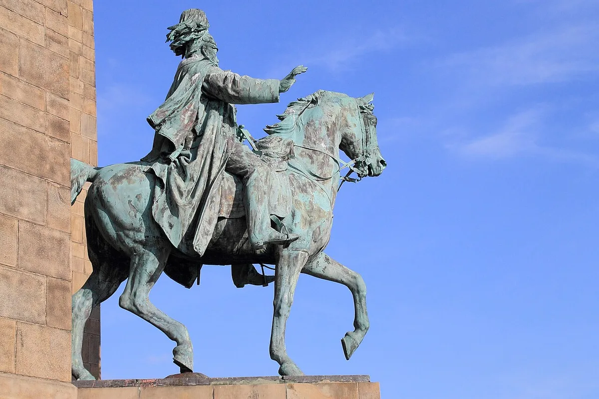
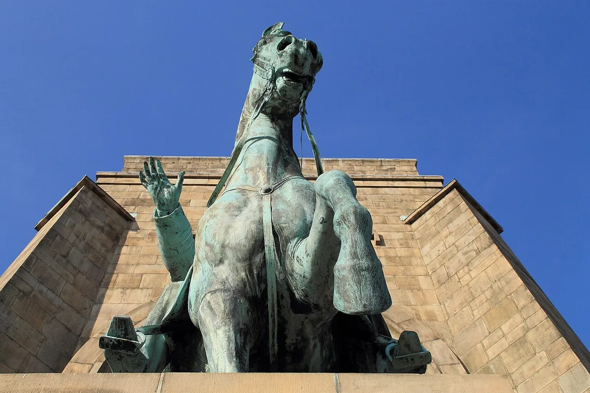
The monument that now dominates the plateau opened in 1902 and was conceived as a monumental group of three towers with rich neo-Gothic architectural ornament, designed by the architect Hubert Stier. In front of the tower structures stood a central equestrian statue of Kaiser Wilhelm I together with standing figures of Otto von Bismarck, Count Moltke, Kaiser Friedrich III and Prince Friedrich Karl. The statues were the work of the Stuttgart sculptors Adolf and Karl von Donndorf.
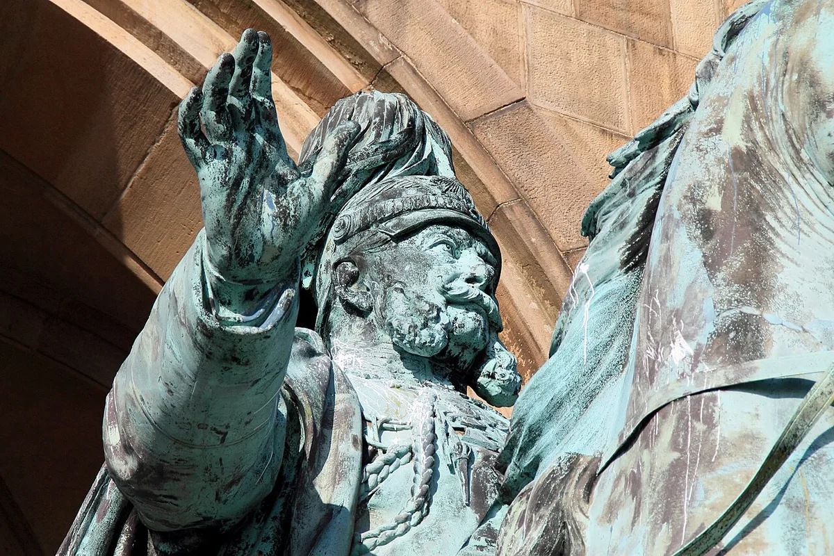
The choice of this site was deliberate. Nineteenth-century German-national monument culture gave the plateau a new function, and the 1902 ensemble turns the Carolingian past associated with the ridge into a staged link to Wilhelm I as the unifier of the Reich. Understanding that intent changes how the architecture reads: the three-tower massing and the sculpture programme are an argument about history, not merely a decorative backdrop.
Do not confuse this ensemble with the Kaiser Wilhelm monument at Deutsches Eck in Koblenz, which stands at the confluence of the Mosel and Rhine and is a different site with its own history and layout. Documentation for one is not documentation for the other, and the two are frequently mixed up in search results. If you are planning a Ruhr trip, the Hohensyburg monument is the one on the ridge above the Ruhr. Further visitor details appear in Kaiser-Wilhelm Monument, Koblenz, Germany - Reviews, Ratings, Tips and Why You Should Go – Wanderlog.
Reading the Views: What a Viewpoint Visit Actually Involves
The appeal of the plateau is geographic rather than architectural: it is a spur about 140 metres above the Ruhr, ringed by the river and by small stream valleys, with the land falling away on three sides. That configuration produces wide valley views from several points along the ridge, and it is the reason the site works as a vantage point rather than simply a monument. Because the approach is essentially from the northeast, the sense of exposure builds as you move toward the southern edge.
A viewpoint visit here is less a single panorama stop and more a walk between separate viewpoints, so allow time to move between the castle remains, the tower and the monument terrace. The grounds have been repeatedly reshaped since the nineteenth century through construction, paths and green space created to open the plateau up to visitors. That reshaping means some of what you walk across is modern landscaping layered over an archaeological site.
For a comparable garden-and-landscape outing closer to the city centre, the Rombergpark Botanic Garden visitor guide is a useful contrast piece, since it presents a designed landscape rather than a defensive spur. Pairing the two helps you decide how much of your Dortmund time to give to greenery generally.
Practical Planning: Suggested Duration and What to Confirm
A suggested duration of roughly one and a half to two and a half hours on site is a planning estimate, not an official figure, and it assumes you walk the plateau and look at all three layers without lingering. Add time if you want to sit at the viewpoints or read the information on the ruins carefully. Because the site is on a ridge with one main approach from the northeast, budget a little extra for getting up and back down.
Decide in advance how much of the site you want to cover, because the ruins, the tower and the monument involve different amounts of effort and different vantage points. Check whether the individual elements you most want to see are actually accessible on the day, and treat anything a third-party listing says about restricted access, ramps or step-free routes as unverified for this site. The open-air elements are what you come for; how far you can go into or up any structure is the part to confirm locally.
Confirm current conditions through the site's managing body before travelling, and check the city's own tourism pages for any seasonal information or closures that affect the southern edge of Dortmund. If a specific access point, event or facility matters to your trip, ask directly rather than relying on older descriptions. A dated photograph such as this 2023 view of the monument confirms what the ensemble looks like, but it proves nothing about current access or status.
Fitting Hohensyburg into a Dortmund Trip
Hohensyburg works best as one half of a day rather than a standalone destination, because the ridge itself is compact and the journey out and back is part of the effort. The site sits directly on Dortmund's southern edge, so it combines naturally with anything else you are doing in the southern or western parts of the city. If you are building a wider programme, day trips from Dortmund covers the regional options beyond the city boundary.
Indoor attractions make a sensible counterweight when the weather turns, and the DASA Working World Exhibition visitor guide is a strong choice for a rainy afternoon because it is an exhibition rather than a landscape. If football history interests you more, the Borusseum visitor guide covers the club museum side of the city. Neither is a substitute for the ridge, but both keep a day productive when the plateau would be miserable.
Plan Your Visit
Hohensyburg is worth visiting for the combination rather than any single element: an early medieval rampart, a ruined stone castle, an 1857 sandstone lookout tower and a 1902 neo-Gothic imperial monument share one plateau above the Ruhr. Knowing the chronology in advance turns a pleasant walk into a legible one.
Plan around the walk and the views, keep a suggested duration of roughly two hours in mind as your own estimate, and confirm access and any current restrictions with the site's managing body before you travel. Because the plateau has one main approach from the northeast, treat the climb as part of the visit rather than an afterthought.
Frequently Asked Questions
What is the Hohensyburg and where is it located?
It is a fortified plateau on Dortmund's southern edge, roughly between Dortmund and Hagen, where a triangular ridge rises about 140 metres above the Ruhr and is enclosed by the river and small stream valleys. The site holds the remains of a medieval castle and earlier ramparts, the 1857 Vincketurm and the Kaiser Wilhelm monument that opened in 1902. Syburg, the district on its northeastern side, is today part of Dortmund.
Is the Kaiser Wilhelm Monument at Hohensyburg the same as the one in Koblenz?
No. The Hohensyburg ensemble is a three-tower neo-Gothic monument designed by Hubert Stier, opened in 1902, with sculpture by Adolf and Karl von Donndorf, and it stands on a ridge above the Ruhr near Dortmund. The monument at Deutsches Eck in Koblenz is a separate site at the confluence of the Mosel and Rhine, and guides to one should not be used as facts about the other.
What is the Vincketurm and can you go up it?
The Vincketurm is an octagonal lookout tower about 26 metres high, built in 1857 in Ruhr sandstone with neo-Gothic detailing and named after Ludwig Freiherr von Vincke. It was shelled during the Second World War after being used as an artillery observation post and was reconstructed in 1955. Whether the tower is open to climb on a given day is not something the managing body publishes in a dependable form, so confirm locally before you plan on going up.
How long do you need at Hohensyburg?
A suggested duration of roughly one and a half to two and a half hours is a personal planning estimate rather than an official figure. It covers walking the plateau and looking at the castle remains, the tower and the monument, and it does not include travel to and from the site. Add time if you want to linger at the viewpoints or read the on-site information about the excavations.
Do you need to check opening times or tickets before visiting Hohensyburg?
Yes, check with the site's managing body and the city's tourism pages rather than relying on outdated guides. The open-air elements are the main draw, but access to individual structures and any conditions affecting the southern edge of Dortmund can change, and older third-party listings may not reflect the current situation. Treat details about ramps, step-free routes and restricted access as unverified until confirmed directly.


