

Rothenburg ob der Tauber is usually visited as a walled town, but its official 2026 theme year, Rothenburg – Stadt.Landschaft.Natur, frames the surrounding landscape as part of the visit rather than a side trip. That framing is useful because the Tauber valley begins directly below the old town. A half-day walk down and back is one of the few ways to see Rothenburg from outside its own walls.
The practical question is not whether you can reach the river, but how you return. Retracing your steps, looping back on a different side and staying low in the valley each give you a different mix of navigation effort, variety and climb. The suggested planning duration here is a non-official estimate, not an official figure.
Why the Walk Out of Town Matters
Rothenburg's tourism office presents the town as a base for walking and nature as well as a historic old town. Its 2026 theme year, Rothenburg – Stadt.Landschaft.Natur, is a dated programme, so treat schedules tied to it as specific to that year rather than permanent. The same pages list events such as an autumn hiking week in October 2026 and Christmas market dates for November 2026, plus further editions published for 2027.
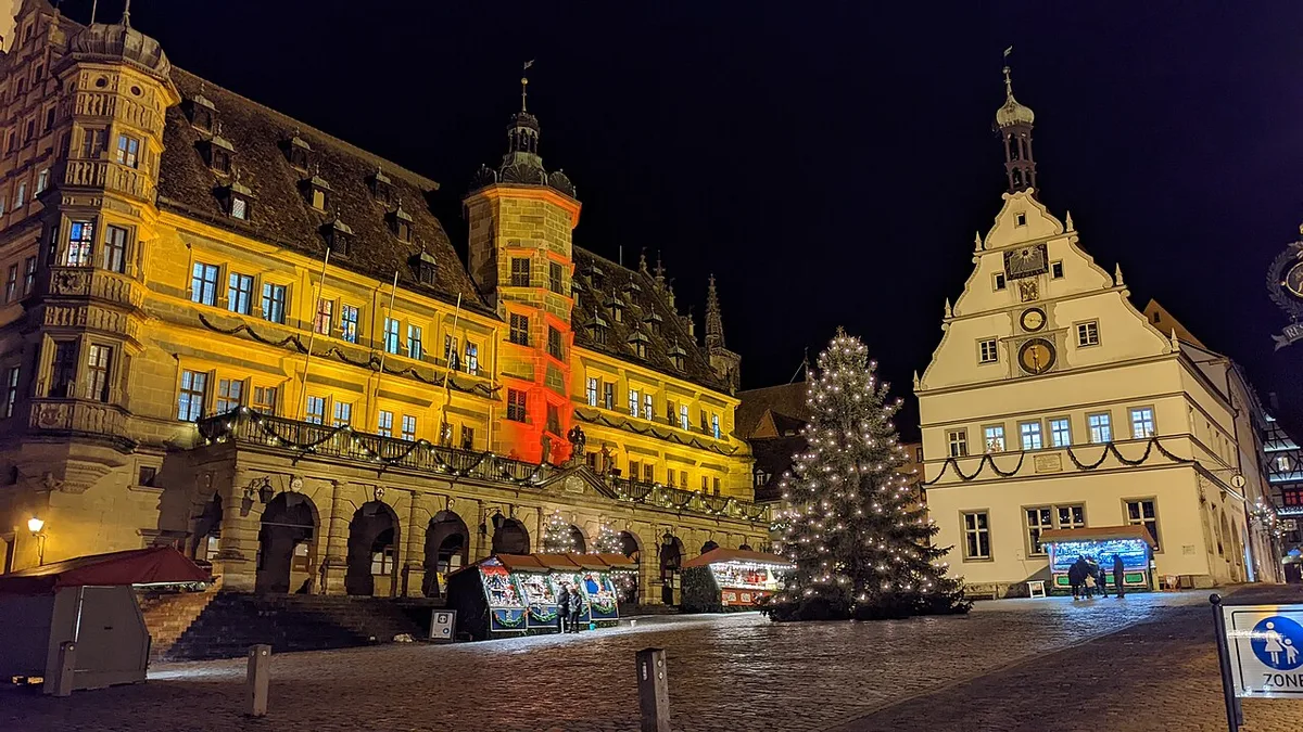
Knowing this matters because day-trippers tend to spend their whole visit inside the walls. The valley floor gives you vineyards, riverbank paths and long views back up at the skyline. Checking Rothenburg Tourismus Service before you go is the simplest way to confirm current local information instead of relying on last year's listings.
Where the Descent Begins
The German National Tourist Board illustrates its Tauber Valley Panorama Trail page with the junction of Kobolzeller Steige and Spitalgasse at the Plönlein, using that street corner as the trail's Rothenburg image point. That makes the Plönlein the natural orientation landmark before you leave the old town. From there, downhill streets carry you toward the river rather than back into the market square.
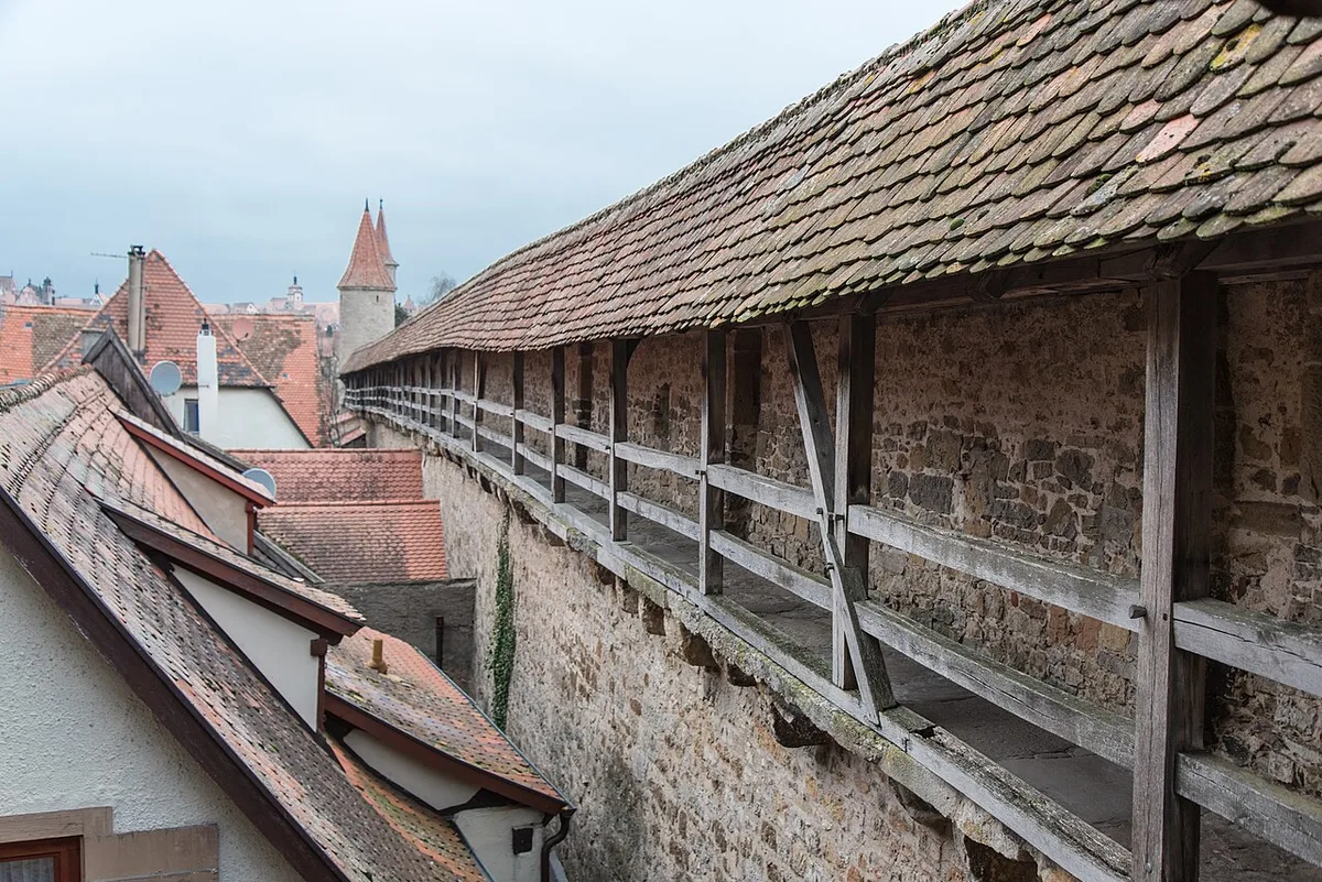
Because the old town sits above the valley, almost every route down involves a gradient rather than a flat approach. Plan your descent so you are fresh and your footing is sure, and keep the return in mind before you commit to the slope. If you are setting out early, note where you intend to re-enter the walls so you are not searching for a stairway at dusk.
The Reported Route via Kurze Steige
Visitors report that a walking street called Kurze Steige leads from the town centre down to the Tauber valley and the river. Treat this as a reported route rather than an official waymarked trail entrance. No source in this guide gives a verified distance, walking time or step count for the descent, so pace yourself by feel rather than by a published number.
Once you are below the walls, the river corridor lets you continue along the water for as long as you choose. That flexibility is exactly why the return decision matters more than the descent route. If you keep walking downstream without a plan, you gradually lengthen the climb or the walk back into town.
What You See at River Level
From the wall tops you get rooftops and towers; from the valley floor you get the river, meadows and slopes with the town skyline above you. Along the Tauber, the trail network is associated with vineyards, castles, mills and half-timbered villages, with Müller-Thurgau among the local white wines. That landscape context is what makes the descent feel different from another lap of the old town.
There is also a reported beer garden setting called Unter der Linden by the river, which visitors describe as a spot to relax at valley level. For current service, menus and whether it is open on your date, check locally on arrival rather than assuming it is operating. Treat any river-level stop as a pause, not a guaranteed part of the route.
A Suggested Half-Day Shape
As a non-official planning estimate, allow roughly half a day for a descent, time at river level and a return to town. That label matters: no source used here states an official duration for the valley walk. Your own pace, photo stops and how far you wander along the river will move the figure considerably in either direction.
If your half-day is short, prioritise a single descent and a river-level stretch over trying to cover several directions. If you have more time in town, a separate visit to the Detwang St. Peter and Paul church near Rothenburg visitor guide can pair with the walk, since that village lies toward the valley. Keep the two outings distinct so neither feels rushed.
The Panorama Trail as Context, Not a Route to Copy
The Tauber Valley Panorama Trail is a long-distance route published with a start in Rothenburg ob der Tauber and a destination of Freudenberg, a length of 133 kilometres across five legs, and height data of 138 metres at its lowest and 450 metres at its highest. Those figures belong to the whole trail, according to the German National Tourist Board, and are not a description of a half-day descent. Use them to set expectations, not to plan your afternoon.
The trail's waymark is described as a hiking boot on a red background, which is worth recognising if you happen to meet it. Following a multi-day leg out of town would turn a half-day plan into a full-day commitment with a harder return. Keep the valley walk as a local loop or out-and-back unless you have deliberately arranged a longer itinerary.
Return Option 1: Retrace Your Descent
Walking back up the way you came is the least risky choice because you already know the surface, the corners and where the stairs are. The trade-off is repetition: the same views twice, and the climb arrives with no novelty to distract you. It is the best option in poor light or when you have already used most of your half-day at river level.
If you choose this, note the junction you left from so you can find the same entrance again. Retracing also removes the need for a map beyond your own memory of the route down. That simplicity is worth real value when daylight is fading.
Return Option 2: Loop Back on a Different Side
A loop gives you two sets of views for one climb, but it asks more of your navigation. You need to identify a different entrance back into the old town and the connecting path along the valley floor before you start. Carrying a map, or an offline copy on your phone, is the practical price of that variety.
Loops suit confident walkers with time to absorb a wrong turn or two. If your schedule is tight or the weather is closing in, the loop's advantage shrinks quickly. Decide before you descend whether you are willing to accept that extra uncertainty.
Return Option 3: Stay Low and Decide Later
You can also walk the river corridor in one direction and treat the return as a separate decision made from the valley floor. This keeps your options open and lets you judge your energy honestly before committing to a climb. The risk is that the longer you stay low, the more effort the eventual ascent costs you.
This approach works well if you have a clear turnaround time and are comfortable retracing from wherever you end up. It suits walkers who value flexibility over a fixed loop. Pair it with a weather check so you are not making that decision in rain or wind.
Weather, Daylight and Season
A spring or autumn descent behaves differently from a high-summer one: surfaces can be wetter, daylight is shorter, and the valley can be cooler than the sheltered old town. Rothenburg's own event calendar places an autumn hiking week in October, which signals when local walking activity peaks. Confirm the exact dates through Rothenburg Tourismus Service rather than assuming they repeat unchanged.
Start earlier than you think you need to if your half-day runs into the afternoon, and keep a margin for the climb. In high summer, carry more water than the distance alone would suggest. In shoulder seasons, a light layer pays for itself once you are below the walls.
What to Carry and How to Handle the Climb
The descent is the easy part; the return climb is the real difficulty, and it will feel harder than the way down even on the same path. Wear shoes with grip for sloping, potentially uneven surfaces rather than smooth soles. Carry water and keep your hands free for railings or walls where they exist.
Leave heavy shopping bags in town rather than carrying them into the valley and back up. If you plan a river-level pause, budget that time into your return rather than discovering it at the foot of the slope. A short rest before the climb makes the ascent noticeably more manageable.
Combining the Walk with Town Sights
A half-day valley walk does not have to consume your whole Rothenburg visit, but it does compete with museum time. Many of the town's interiors are ticketed and separate from the free, open landscape, so decide in advance whether your half-day budget goes to viewpoints or collections. The 2 days in Rothenburg ob der Tauber itinerary shows how a valley outing can sit alongside town sightseeing without duplication.
If your trip is built around short excursions, day trips from Rothenburg ob der Tauber can be arranged so the valley walk stays a local half-day rather than a travel day. Keep the walk close to town and let longer outings use separate days. That separation protects both experiences.
Mistakes to Avoid
The most common mistake is treating the valley as an automatic loop. Some routes are out-and-back unless you have identified a genuine connecting path, and assuming otherwise can leave you improvising at the end of the day. Decide the return before you descend, not after.
The second mistake is underestimating the climb back into town, especially after a long river-level wander. The third is copying a leg of a long-distance trail as if it were a half-day walk; the Tauber Valley Panorama Trail spans 133 kilometres across five legs and is a different undertaking. Check current conditions and any local advice with the town's visitor service before setting out.
Plan Your Return Before You Descend
A Tauber valley walk from Rothenburg works best as one clear decision: pick a descent, spend your river time deliberately, and commit to a return strategy before you leave the old town. Retracing is simplest, looping needs a map, and staying low keeps your options open at the cost of a longer climb later.
Check Rothenburg Tourismus Service for current local information, event dates and any conditions affecting the paths. Carry water, wear grippy shoes and treat the climb back as the day's real effort. With the return settled in advance, the half-day descends into a landscape that most day-trippers never see.
Frequently Asked Questions
How long is the walk down from Rothenburg ob der Tauber to the Tauber river?
No verified distance, walking time or step count for the descent is published in the sources used here, so treat any figure you see elsewhere with caution. What is reported is a walking street, Kurze Steige, connecting the town centre to the valley and river. Time it by your own pace and the surface conditions rather than a quoted number.
Can you walk into the Tauber valley from Rothenburg without a car?
Yes. The valley begins directly below the old town, and the descent is on foot, so no vehicle is required for a half-day outing. The practical constraint is the climb back, not transport. Decide your return route before you descend and carry what you need for the ascent.
Should you retrace your steps or loop back on a valley walk?
Retracing is the safest option because you already know the path, with the trade-off of seeing the same views twice. A loop offers variety but requires a map and confidence in finding a different entrance back into town. Staying low and deciding your return from the valley floor keeps options open but can lengthen the eventual climb.
Where does the Tauber Valley Panorama Trail start and end?
The German National Tourist Board publishes the trail with a start in Rothenburg ob der Tauber and a destination of Freudenberg, a length of 133 kilometres over five legs. Those figures describe the full long-distance route, not the half-day descent from town. Use the trail as context and keep your valley walk local unless you plan a longer itinerary.


