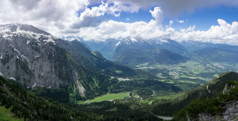
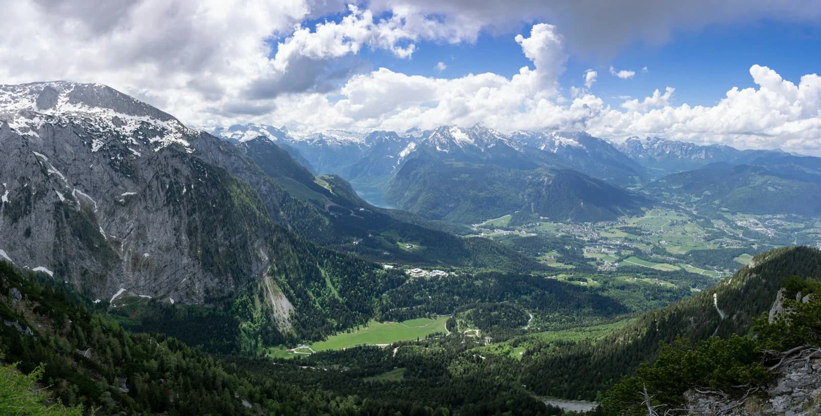
The Rossfeld Panorama Road is the high loop above Berchtesgaden that turns a short drive into a proper mountain outing. It climbs through alpine pasture to a summit plateau that runs partly on Austrian territory, so one continuous route crosses a national border. This guide focuses on the decision that matters most before you go: whether to drive, ride a motorcycle, or pedal the same road.
That decision changes your timing, which toll you pay, and how much of the plateau you actually see. The destination page presents the road as a drive, motorcycle ride or mountain bike outing, and lists cycling routes for road and mountain bikes. A third-party trip report describes about two hours for the drive with photo stops and a picnic, but that is one visitor's account, not an official figure.
Before you commit to a day, decide whether the road is the point or a link in a larger plan. The Berchtesgaden: Landmark Visitor Guides pages cover the surrounding sights, while this guide stays with the road itself: its two approaches, its summit parking and its constraints. Tolls, opening status and maintenance rules come from the operator and destination listings.
What the Rossfeld Panorama Road Actually Is
The road is classified as a federal private road because there is no supra-local connection, and the destination page describes it as the country's highest toll road, reaching about 1,600 metres. The operator says maintenance costs two to three times more than for a valley federal road, and around 100,000 vehicles use it each year. The toll revenue finances that upkeep, further expansion and administration.
Construction began in 1938 under the German Alpine Road project management, intended as the final loop of that route. The road was also meant to give visitors a distant view of the high-security Obersalzberg area, closed to the public from 1937. It was only completed after the war by the Traunstein road construction office, which gives the drive a layered history rather than pure scenery.
The summit section runs east of the Hennenkamm, the ridge that marks the national border. About 1.5 kilometres of the road lies on Austrian territory, so you cross and recross the boundary without any checkpoint. The destination page describes this connecting stretch as a high plateau with almost no inclines, which is why the plateau feels calmer than the climbs at either end.
The Two Toll Booths and Their Approach Roads
There are two ways onto the road, and the operator lists the north toll booth at Rossfeldstrasse 150 and the south booth at Purtschellerstrasse 1. The southern ascent climbs from the Klaushoehe on the Obersalzberg over the south toll booth to Ofnerboden, passing the Enzianbrennerei Grassl distillery hut and the Untere Ahornalm before reaching the Obere Ahornalm below the Ahornbuechsenkopf at 1,604 metres.
The northern ascent starts in Berchtesgaden-Oberau and runs through Gmerk, Dora and Heissbaeck, past Madlerlehen and Pechhaeusl, to the north toll booth. From there it winds through the Rossfeldalm area to the parking lot at the Hennenkoepfl. The destination page notes that the 10-trip pass is sold only at the north toll station in Oberau, so a regular visitor should enter from that side.
If you are deciding between the two, the southern approach is the one that doubles as a trailhead. Ofnerboden is the starting point for the hike to the Kehlsteinhaus, which makes it the natural link between the road and the Eagle's Nest area. The northern approach, by contrast, is the winter side: the destination page says that part of the Rossfeld serves as a ski area with the region's most reliable natural snow.
The Summit Plateau, Hairpins and Gradients
Going up from the south, the first very sharp right-hand turn between the Untere and Obere Ahornalm is known as the Regerkurve, named after a German rally driver. Immediately after it the road reaches its steepest incline, so this is the section that demands the most care in a car and the most effort on a bike. Knowing the sequence helps you anticipate the technically hardest corner rather than meeting it by surprise.
The plateau itself is the reward: a near-level connecting stretch with several parking lots along the highest part of the road. The operator page lists around 400 parking spaces at the viewpoints, spread across the route rather than concentrated at one summit square. That layout means you can stop at more than one panorama instead of circling for a single space.
From those pull-offs the view opens across the Hoher Goell massif, the Kehlstein, the Tennen and Dachstein ranges, the Untersberg, and both the Berchtesgaden and Salzburg regions. Because the road sits on a plateau rather than a single peak, the panorama changes as you move, and the view down into the Salzach Valley drops more than 1,000 metres. The destination page treats the road as the end of the German Alpine Road, which is worth remembering if you are following that longer route.
Tolls, Opening Status and What They Cover
The operator page lists the car toll at 9.50 euros including driver and passengers, a motorcycle at 6 euros including rider and passenger, and a bus at 60 euros including passengers. The 10-trip pass is listed at 73 euros for a car and 45 euros for a motorcycle, again available only at the north toll station in Oberau. Treat these as the figures the operator currently publishes and confirm them at the booth or the official site before you travel.
The operator page explains that the toll funds the whole maintenance burden of a road that is expensive to keep open, which is the practical reason a fee exists on what looks like a simple mountain lane. The same page states that the road is open year-round. A third-party travel blog mentions paying about 9 euros per car at the time of writing, which is not a substitute for the official figure, so use the operator price if you are budgeting.
Because toll amounts, opening status and seasonal conditions can change, the safest planning step is a quick check of the operator information page before you set out. If you find a figure that differs from what you read here, the operator's published rate is the one that applies at the booth. Do not build a tight budget around any single number found on a travel blog.
Car, Motorcycle or Bicycle: Choosing Your Vehicle
A car gives you the most flexibility for combining the plateau with short walks, and the passenger can watch the panorama while the driver concentrates on the hairpins. The trade-off is that the driver sees less of the view on the climb, and parking at the most popular pull-offs can be busy on clear weekends. If photography is the priority, plan to stop at several lots rather than one.
A motorcycle suits the road's rhythm, and the destination page notes it is popular with motorcyclists, with the Regerkurve and the steepest section rewarding smooth throttle control. The toll for a motorcycle or sidecar including rider and passenger is lower than for a car, which matters over repeat visits. Check weather and surface conditions independently before committing, because the road climbs to a high plateau.
Cycling is a genuine option rather than an afterthought: the destination site lists a road bike route of 24.4 kilometres with 1,035 metres of climbing and a mountain bike route of 29.3 kilometres with 1,155 metres of ascent. Those listed distances and elevation gains show that this is a serious climb, not a flat scenic loop, so gearing and fitness decide whether it is enjoyable. The toll applies to vehicles, so a cyclist's costs differ from a car driver's, and the 10-trip pass is a car or motorcycle product.
Viewpoints, Parking and Trailheads
The plateau is the best place to plan stops, because the parking lots sit where the panorama is broadest and the walking trail along the summit offers an even wider view. From there you can pick out the Hoher Goell, the Untersberg and the Salzburg basin, and on a clear day the Chiemgau region. The best viewpoints in Berchtesgaden pages cover alternatives at lower elevation if the plateau is busy.
Hikers should note the two named trailheads: the Purtschellerhaus at 1,692 metres and the Kehlsteinhaus at 1,834 metres both start from the panoramic road. This is what turns a drive into a half-day or full-day outing, since the road puts you at altitude before the climb begins. Allow more time than the driving alone suggests if you plan to walk either route.
The destination listing also names places to eat along the route, including the Rossfeldalm, the Rossfeld-Skihuette, the Ahornkaser mountain restaurant, the Rossfeld Schmankerlkiosk and both the upper and lower Ahornalm. Opening days for those huts vary, and the destination listing itself showed some as closed on the day it was published, so check before relying on a hot meal at a specific spot. Carry water and a snack as a fallback.
Linking the Road with the Kehlsteinhaus Area
The southern approach is the practical bridge to the Eagle's Nest area: the road leads to Ofnerboden, which the destination page names as the starting point for the hike to the Kehlsteinhaus. That makes a single day possible with the car parked lower down and the rest done on foot. Keep the two arrangements separate in your mind, because the road's toll and the Kehlsteinhaus access are different systems.
The Dokumentation Obersalzberg visitor guide covers the historical site on the same mountain, and pairing it with the Rossfeld drive gives the day a context beyond the panorama. The Obersalzberg is also where the southern ascent begins at the Klaushoehe, so the geography links naturally. If your interest is primarily historical, plan the documentation centre and the Kehlstein area as a separate block from the plateau drive.
Do not assume the road's operator publishes anything about Kehlsteinhaus opening dates, bus tickets or booking rules; those arrangements sit with a different operator and should be checked at their own source. Treat the road as transport and hiking access and confirm the rest separately. This separation is the most common source of confusion for first-time visitors.
Rules, Restrictions and Sensible Precautions
The operator states that overnight stays in vehicles and camping along the entire route and in its associated car parks are not permitted. This is a firm rule covering the whole road, not just the summit, so it rules out sleeping in a camper or car at a viewpoint. If you want to stay overnight in the area, arrange accommodation in Berchtesgaden or the surrounding villages instead.
Photo and film shoots and test drives require prior arrangement and booking through the operator's registration forms, because the road is a popular backdrop for both. If your visit involves professional equipment, models or a vehicle test, contact the operator before the day rather than turning up. Ordinary tourist photography from the parking areas is a different matter from an organised shoot.
The available sources do not detail accessibility provisions, winter closures at short notice, security rules or ski-lift and snow conditions, so verify those directly with the operator if they affect your plan. Weather on a 1,600-metre plateau can differ sharply from Berchtesgaden town, so check conditions before climbing. Building in a flexible day is wiser than fixing a tight schedule.
Plan Your Rossfeld Drive or Ride
Decide first whether the road is your destination or a staging point, because that settles your entry and your timing. A pure scenic drive uses the plateau and its viewpoints; a hiking day uses the southern approach at Ofnerboden for the Kehlsteinhaus or the plateau trailheads for the Purtschellerhaus. Both work, but they need different amounts of time.
Then choose your vehicle honestly: a car for flexibility, a motorcycle for the road's character, or a bike if the listed 24 to 29 kilometre routes with over 1,000 metres of climbing match your fitness. Confirm the current toll and opening status with the operator before you go, and remember the no-overnight-stays rule if you travel in a camper.
For the rest of your stay, the Berchtesgaden: Itineraries and City Travel Guides and the day trips from Berchtesgaden pages help you fit the Rossfeld loop alongside the lake, the salt mine and the Jennerbahn cable car and summit guide. Booking a clear day for the plateau gives you the panorama the road is known for.
Frequently Asked Questions
Do you have to pay a toll to drive the Rossfeld Panorama Road?
Yes. The road is a federal private road with no supra-local connection, and the toll funds its maintenance, expansion and administration. You pay at one of the two toll booths, north at Rossfeldstrasse 150 in Oberau or south at Purtschellerstrasse 1, and the rate depends on your vehicle type. Buy the multi-trip pass only at the north toll station, as the operator lists it that way. Check the operator information page for the rate that applies on your travel date rather than relying on an older trip report.
Can you cycle the Rossfeld Panorama Road?
Yes. The destination site lists a road bike route of 24.4 kilometres with about 1,035 metres of climbing and a mountain bike route of 29.3 kilometres with roughly 1,155 metres of ascent, so both are serious mountain outings. The steepest section follows the Regerkurve hairpin, and the summit plateau is comparatively level, which shapes how you pace the ride. Toll arrangements for a bicycle differ from those for a car or motorcycle, so confirm at the booth.
Can you camp or sleep in your vehicle along the Rossfeld Panorama Road?
No. The operator states that overnight stays in vehicles and camping along the entire route and in its associated car parks are not permitted. That covers the summit parking lots as well as the approach roads, so a camper or car is not a place to sleep on the mountain. Arrange accommodation in Berchtesgaden or a nearby village and treat the road as a daytime outing only.
How does the Rossfeld road connect to the Kehlsteinhaus?
The southern approach leads from the Klaushoehe on the Obersalzberg over the south toll booth to Ofnerboden, which the destination page names as the starting point for the hike to the Kehlsteinhaus. That makes the road a practical way to begin the climb on foot rather than a separate attraction. Kehlsteinhaus opening dates, bus tickets and booking rules are handled by a different operator, so check those separately and do not assume the road page covers them.
Is the Rossfeld Panorama Road open all year?
The destination page lists the road as open year-round, but that does not guarantee the surface or the weather will suit your plan on any given day. The summit sits on a high plateau that partly crosses Austrian territory, and conditions there can differ from Berchtesgaden town. Because short-notice winter closures and current status are not detailed in the available sources, check with the operator before setting out in uncertain weather.
How long should you allow for the drive?
One travel blog describes about two hours for the drive including photo stops and a picnic, but that is a single visitor's experience rather than an official figure. The road climbs to roughly 1,600 metres through hairpins and then opens onto a near-level plateau with several parking lots, so time depends heavily on how often you stop. Add extra hours if you plan to walk to the Purtschellerhaus or the Kehlsteinhaus, because both trailheads start at the road.