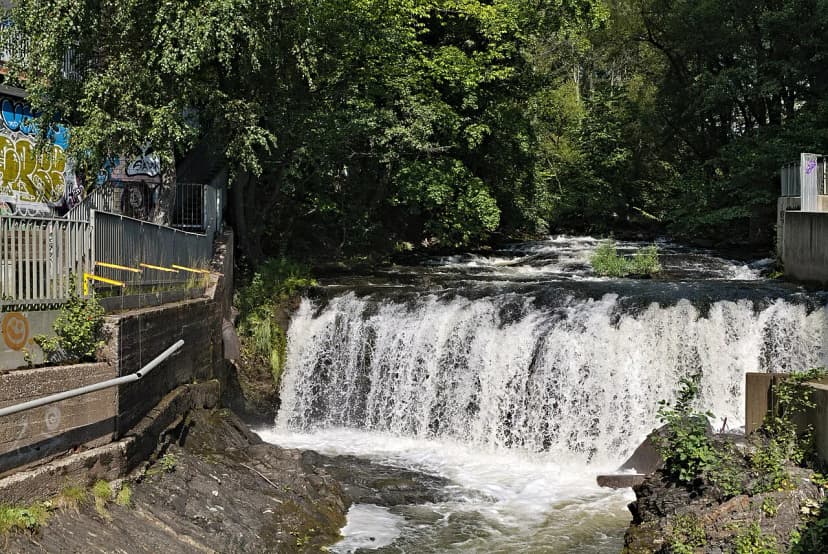

Last updated October 2026: this guide to the Akerselva river walk Oslo visitors can do in an hour or an afternoon compares two ways to walk it. One is the short central stretch around Mathallen. The other is the longer industrial-heritage route that starts upstream at Nydalen and ends near the fjord.
Akerselva river walk Oslo: which section fits your day
Akerselva is 8.2 km (5.1 miles) long. It runs from Maridalsvannet lake through Oslo and into the fjord. Local tourism sources describe a path past forest, old factories, swimming spots and roughly twenty waterfalls that once powered the city's industry.
You do not have to walk all of it. A steady pace over the full trail takes 2–3 hours. Add stops for waffles, photos and the odd museum, and it stretches to 4–5 hours. If you only have one hour, stay on the Sagene to Grünerløkka stretch. That is where the bridges, the food hall and the street art sit closest together.
Both routes follow the same river and share the same sights. They differ in mood. Downstream, you get cafés, a food hall and music venues. Upstream, you get ruins, mills and quieter paths. The table below sets the two options side by side.
| Option | Distance and time | Best for | Main stops |
|---|---|---|---|
| Central stretch | Short walk; plan about 1 hour | Food, street art, evening atmosphere | Mathallen, Seilduken, Aamot bridge, Brenneriveien |
| Full industrial trail | 8.2 km; 2–3 hours steady, 4–5 hours with stops | Industrial history, waterfalls, swimming | Nydalen, Bjølsen, Sagene, Grünerløkka, Vaterland |
Getting there and choosing a direction
Walk north to south. The river drops toward the fjord, so you stay mostly downhill. Starting at the fjord and heading upstream means a constant climb, which is the most common planning mistake.
For the full route, start in Nydalen. Take Metro line 4 or 5 to Nydalen station. From there, walk through the Torgbygget shopping mall to reach the river. Cross the bridge and turn right. After 2–3 minutes you reach a preserved factory building, which is where the walk properly begins.
For the short route, start near Mathallen and Vulkan and follow the river in whichever direction suits your energy. Check Ruter's journey planner for current lines, stops and ticket options. This guide does not state station exits or fares, because those change and you should confirm them on the day.
- Full trail: Metro line 4 or 5 to Nydalen, then walk downhill toward the city.
- Short stretch: begin around Vulkan and Mathallen, then wander along the river.
- Wrong way round: starting at the fjord means uphill all the way.
The central stretch: Mathallen, Seilduken and Aamot bridge
This is the stretch to pick if food and atmosphere matter more than history. Vulkan is a former industrial site by the river, now home to hotels, culture venues and restaurants. Its centre is Mathallen Oslo, a food hall in a large old factory building. Tourism sources count about 30 specialty stores, cafés and eateries inside.
Buy cheese, ice cream or a full meal and carry it outside. Several outdoor spaces sit close by, right next to the river. Dansens Hus, Norway's national stage for dance, is also at Vulkan. Its bar looks out over the water.
Upstream from Vulkan, the path passes Seilduken, a former canvas factory. It now houses the Oslo National Academy of the Arts. A neon work called "This is it" by Gardar Eide Einarsson sits on the roof. A nearby bridge is covered in engraved padlocks, and the waterfall behind it is lit at night.
Next comes Aamot bridge, a chain suspension bridge dating to 1851 that was moved here in 1952. An inscription on a pillar reads "100 men I carry, but fail during steady march." The warning has a real basis. A French bridge of the same design collapsed under marching soldiers in 1850. The old planks sway slightly, so cross at an easy pace.
Brenneriveien is the creative strip of this section. Expect sculptures, graffiti, the music venue BLÅ and its riverside patio. Ingensteds, a culture hub in an old textile factory, sits across from it. Late afternoon suits the patios, and evenings bring lights along both terraces. For more on this district, see our Grünerløkka neighborhood guide.
- Mathallen: about 30 shops and eateries under one roof.
- Seilduken: art academy, rooftop neon and the padlock bridge.
- Aamot bridge: 1851 suspension bridge with the marching warning.
- Brenneriveien: street art, BLÅ and Ingensteds.
The longer walk upstream: Nydalen, Bjølsen and Sagene
Choose this route if you want the story of how the river built Oslo. In the 19th century, factories used the water's power. Today the river is cleaned up and often called Oslo's green lung.
Nydalen is modern, with offices, a business school and shopping centres. Its river bath has artificial ponds and small waterfalls, which makes it popular with families. Be aware of the current so you do not drift back toward your starting point. Swim only at designated spots such as Nydalen or Frysja.
Bakke Mølle dates to 1811. Hans Nielsen Hauge, a preacher, had the mill built, and it later passed to a spike-making company that wanted the waterfall. Today the building holds local government offices.
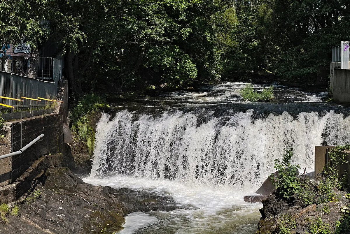
Bjølsen follows, with old workers' housing and green areas. Bjølsenfossen drops 16 metres and is nicknamed Little Niagara. It sits inside the old mill area, so you mostly hear it rather than see it. Source pages disagree on which fall is the tallest, so treat height rankings with caution.
Sagene is the heart of the industrial story. Beierbrua is known as the factory girls' bridge. It linked textile mills on the west bank with housing on the east. A 1986 sculpture by Ellen Jacobsen stands there.
Nearby is Hønse-Lovisa's House, a small red cottage turned café. Tourism sources recommend it for waffles and a view of the river. Its name comes from a character in Oscar Braaten's writing about working-class life. Path access near Mølla is steep, and you pass through a cloud of spray.
The Workers Museum on Sagveien covers labour and industrial history, and is a short detour from the river. Check current opening details before you go. Our lesser-known Oslo spots guide pairs well with this section.
- Nydalen river bath: artificial ponds, best for families.
- Bakke Mølle: 1811 mill, now offices.
- Bjølsenfossen: 16 metre drop, audible from a bridge.
- Beierbrua and Hønse-Lovisa's House: textile history and waffles.
Bridges, gradients and accessibility
Most of the path is gravel or paved, and sneakers are fine. It can turn muddy after rain, so a pair with grip helps. Going north to south keeps the gradient gentle for most of the trail.
Bjølsenfossen drops 16 metres, creating steep terrain near Mølla where gravel slopes challenge strollers and wheelchair access.
Steeper sections appear near Mølla, where the path climbs past the waterfall. Gravel slopes there can challenge strollers and wheelchairs. Most other sections are described as stroller friendly, but check conditions locally.
Bridges give you the easiest way to switch banks and shorten a loop. Beierbrua, Aamot bridge and the padlock bridge near Seilduken are all good crossing points. Watch your footing on Aamot's planks. At the bottom of the trail, Ankerbrua, nicknamed the fairytale bridge, features characters from Norwegian legends. Vaterland Park marks the end of the trail, according to VisitNorway's route listing.
- Surface: gravel and paving; sneakers work.
- Steep spot: the path past Mølla waterfall.
- Bridges to know: Beierbrua, Aamot bridge, Ankerbrua.
- Wet weather: expect mud and slippery stones near falls.
Practical tips, seasons and rainy-day backup
The path is open all year, according to VisitNorway's listing. Summer suits swimming and patios. Autumn brings Elvelangs, a torchlight walk held on the Thursday evening closest to the autumn equinox. Tourism sources say 4,000 torches line the river from north to south. This year's date has passed, so check the next one before planning around it.
Stay back from the water near waterfalls, especially after rain. Swim only in designated spots. If the forecast looks bad, save the walk and use our Oslo rainy day plan instead.
For current route details, VisitOSLO's river guide was updated in September 2026. Cafés, venues and museums can change hours, so confirm each stop before you commit your time.
Vaterland and the urban finish
The trail ends at Vaterland Park, where the river nears the fjord. From there you enter Grønland, a multicultural district. Metro and other connections are nearby, but check Ruter for current services. If you walked downhill from Nydalen, this is a comfortable place to stop with 8.2 km behind you.
Frequently Asked Questions
How long is the Akerselva river walk in Oslo?
Akerselva is 8.2 km (5.1 miles) long. A steady walk takes 2–3 hours. With café and photo stops, plan 4–5 hours.
Which direction should I walk Akerselva?
Walk north to south, from Nydalen toward the city. You stay mostly downhill that way. Starting at the fjord means a constant uphill climb.
How do I get to the start of the walk?
Take Metro line 4 or 5 to Nydalen station. Walk through the Torgbygget mall to the river. Check Ruter for current services and tickets.
What if I only have one hour?
Walk the Sagene to Grünerløkka stretch. It packs bridges, Mathallen, Seilduken and Brenneriveien into a short distance. Add a food stop at Mathallen.
Is it safe to swim in Akerselva?
Swim only in designated spots such as Nydalen or Frysja. Watch the current. Stay back from waterfalls, especially after rain.